
First class analytics for next level precision farming
Industry leading maps characterizing vegetation, based on a vast range of satellite and UAV imagery. |

Innovative decision support platform for precision farming Best-in-class service for providing in-season alerts by managing and fusing imagery, field data and weather insights. |

Glassland Production Index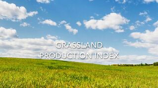
Reliable and objective estimate of pasture production losses
The Grassland Production Index is a service allowing insurers to cover cattle breeders against shortages in forage yield. |
Optical and Radar Constellation
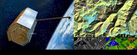
The Most Extensive and Accurate Imagery Solutions with a Unique Constellation
Take advantage of the most extensive and accurate surveillance solutions, with optical and radar satellite imagery, and a wealth of related products and services for smarter decision making. |
Direct Receiving Station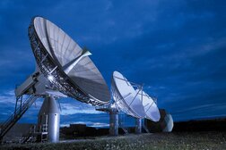
Get direct access to Airbus satellite imagery and process your own products in full security and confidentiality!
The Direct Receiving Station (DRS) enables a direct access to Airbus Defence and Space’s complete Earth observation satellite constellation. |

Pixagri® is a comprehensive service, available worldwide, that gives farming professionals more control over practices and inputs to achieve maximum profitability. |

|
TERRA SPATIUM, Geoinformation and Space Products & Services- Private Security Services Company S.A.
90 Ioannou Metaxa Str., 19441, Karellas Koropi, Greece P.O. BOX 049 | 19002 Paiania Greece HELLENIC BUSINESS REGISTRY NUMBER: 9340801000 Tel.: +30 210 67 48 540 | Fax : +30 210 67 53 780 |
