|
Products/Airbus Defence & Space/Products & Services/Satellite Imagery/Optical
Optical
|
Pleiades Imagery Products
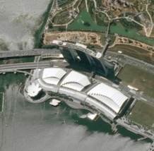
Pléiades is an optical satellite constellation providing Very High Resolution products (50cm) with a 20-km swath. Both the space and the ground segment have been designed to provide information in record time, offering daily revisit capacity to any point on the globe and acquisition capabilities tailored to meet the full spectrum of civil and military requirements. The Pléiades constellation is the right answer to spot the detail and make powerful your decisions.
FEATURES
KEY BENEFITS
FEATURES
- 50-cm resolution, colour, orthorectified imagery.
- 20-km ground footprint at nadir, up to 100 km x 100 km in strip mapping mode.
KEY BENEFITS
- Guaranteed acquisition capacity - Unprecedented commercial availability, committed to deliver
- The right information at the right time - Daily revisit capability, from standard delivery to emergency response
- Flexibility: to monitor and acquire targets, shapes or large areas, from web ordering imagery to Direct Receiving Stations
- Accuracy: ortho-rectified imagery as a standard, high imagery quality
SPOT Imagery Products
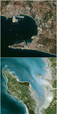
Acquired from the family of the SPOT satellites (SPOT 1, 2, 3, 4, 5 & 6) the SPOT imagery products offer an optimum combination of resolution and coverage. A single SPOT acquisition covers areas with a swath of 60km at resolutions of 20m to 1.5m, with a location accuracy until 10m. Such precise, synoptic coverage is ideal for applications at regional and local scales from 1:100.000 to 1:15.000.
The SPOT archive contains more than 1 billion square kilometers acquired since 1986, a unique database for temporal evolution monitoring. The SPOT satellites can also be tasked to meet time and place requirements.
KEY BENEFITS
The SPOT archive contains more than 1 billion square kilometers acquired since 1986, a unique database for temporal evolution monitoring. The SPOT satellites can also be tasked to meet time and place requirements.
KEY BENEFITS
- Optimal combination of resolution, coverage and accuracy,
- Regional or National coverage in record time,
- Ultimate reactivity from new acquisition ordering to product delivery,
- Accurate orthoimagery guaranteed by Reference 3D database,
- Image availability secured until 2024.
DEIMOS-1 Imagery Products
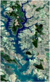
DEIMOS-1 satellite provides Standard Image Products in Multispectral mode at a resolution of 22 metres with an image swath of up to 600km. Scenes are delivered in level 3 (orthorectified product) as a standard and raw data can be delivered on request. DEIMOS-1 images are ideal for production of Value-Added information in Maritime, Agriculture, Environment or Forestry applications. DEIMOS-1 offers a range of archive images or access to standard and priority programming collections.
KEY BENEFITS
KEY BENEFITS
- Fast coverage of territories thanks to its wide swath
- Near-real-time capacity
- Competitive price with archive price starting at € 0,06/sqkm
- Ortho product as a standard
|
TERRA SPATIUM, Geoinformation and Space Products & Services- Private Security Services Company S.A.
90 Ioannou Metaxa Str., 19441, Karellas Koropi, Greece P.O. BOX 049 | 19002 Paiania Greece HELLENIC BUSINESS REGISTRY NUMBER: 9340801000 Tel.: +30 210 67 48 540 | Fax : +30 210 67 53 780 |
